River Valley Formation
Contact
University of Arkansas Division of Agriculture
Cooperative Extension Service
2301 S. University Ave.
Little Rock, AR 72204

River Valley Formation
I find myself stymied by the weather. With six inches of snow on the ground and subzero temperatures, I decided exploring the deep valleys of the Buffalo River Valley was not a wise choice. Instead, let us consider how the river valley formed.
Rocks faithfully record the history of a place, but to understand the message requires careful attention be paid and belief that scientists who have studied the rocks got it right. The Buffalo River Valley is a short story in many respects because it just exposes rocks from the Pennsylvanian age to the middle Ordovician, a scant 150 million year record. The Grand Canyon tells a much longer story, cutting down to basement rocks that are 1.8 billion years old.
Neither the Buffalo nor the Grand Canyon have a record of dinosaurs because the youngest (uppermost) rocks in the Grand Canyon — the Kaibab limestones (270 million years old) and the Pennsylvanian sandstones of the Buffalo (about 300 million years old) — were deposited long before dinosaurs entered the scene. Surprisingly, the Buffalo River may have been around longer than the Grand Canyon.
The Grand Canyon is now believed to have formed in three discreet phases. The oldest section of the canyon formed about 75 million years ago with a second section appearing about 25 million years ago. Then the Johnny-come-lately Colorado River forming about 7 million years ago as snows from the uplifted Rocky Mountains melted and carved a path to the sea.
The alternating layers of sandstone, shale, limestone and dolomite that make up the Arkansas Ozarks were deposited in a marine or coastal environment when the landmass that now makes up the state was positioned along the equator. The record of the ocean’s coming and going over the land is relentless, going on for several hundred million years as the sea level rises and falls. During the upper Ordovician times and through the Mississippian times, the southern portion of what would eventually become the Ozark Dome was a coastal region. It had sandy barrier islands near shore, an assemblage of sea creatures living in shallow waters and limey mud that left behind massive limestone deposits. Shale deposits occurred in deeper water where the finest particles settled.
By Pennsylvanian times this region, while still low lying and coastal, was fed sand from inland rivers. They predominantly flowed from the northeast, probably originating from the slopes of the ancient St. Francois Mountains of southeaster Missouri or the emerging Wisconsin Dome further north. The massive sandstone bluffs of the Boston Mountains show ancient ripple patterns, indicating a directional flow from the northeast, and remain as tangible remnants of these river deposits.
At the end of the Pennsylvanian period, between 300 and 280 million years ago, the collision of South America with the North American plate created the Ouachita Mountains. This pushed the Ozark Dome above the sea, where it has remained high and dry ever since.
If you look at a relief map of Arkansas it is easy to spot the east-west orientation of the Ouachita Mountains south of the Arkansas River Valley, as well as the crazy quilt erosional pattern of the Ozarks to the north. The erosion resistant sandstone bluffs of the Boston Mountains are the youngest rocks in the Ozarks. These young rocks are known as the “Middle Bloyd” formation and surround the Boxley valley on the high ground.
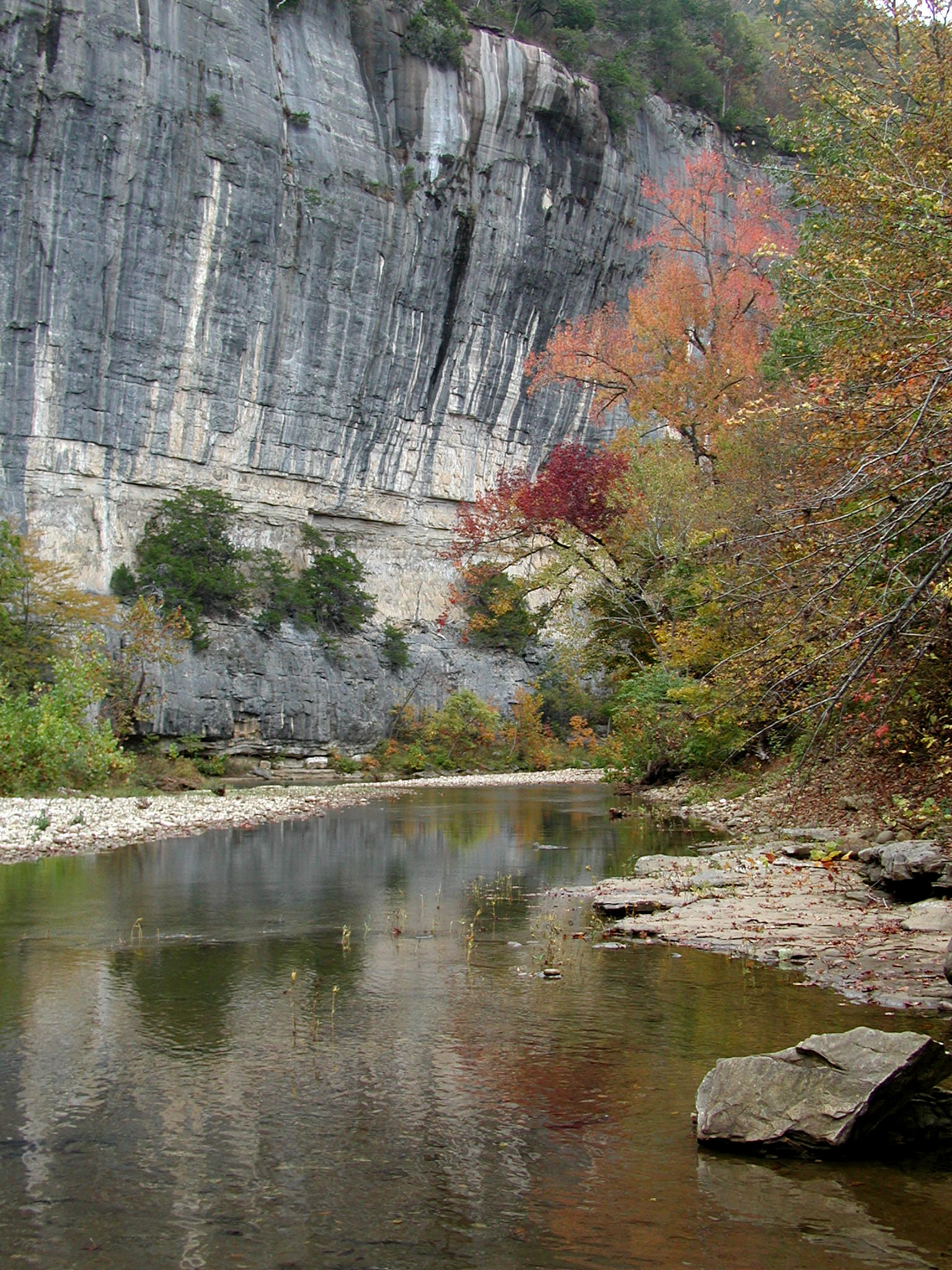
From Lost Valley to Ponca and further east, the river has cut deeper into the layer cake rock strata and has entered the Mississippian age rocks and the region known as the Springfield Plateau. The Boone Limestones, often containing bands of sharp-edged chert, make up the Ponca end of the Boxley Valley. The sharp-edged chert sand bars found along the Buffalo River are the grit that grind into the valley floor and slowly carve the river deeper. Two miles further downriver at Steel Creek is one of the most impressive bluffs on the river, Roark Bluff. This is an Ordovician age deposit of the Everton Formation containing sections of lime-rich sandstone and dolomite.
The Ozark dome has been eroding away for the past 280 million years. The highest part of the dome eroded away first, eventually eating away to the southern edge of the Boston Mountains. The drainage channel that makes up the Buffalo River Valley formed as the erosional front reached the Boston Mountain Plateau. When this happened is uncertain, but it probably happens long before the Colorado River began carving its way to the sea.