Mount Magazine
Contact
University of Arkansas Division of Agriculture
Cooperative Extension Service
2301 S. University Ave.
Little Rock, AR 72204

Mount Magazine
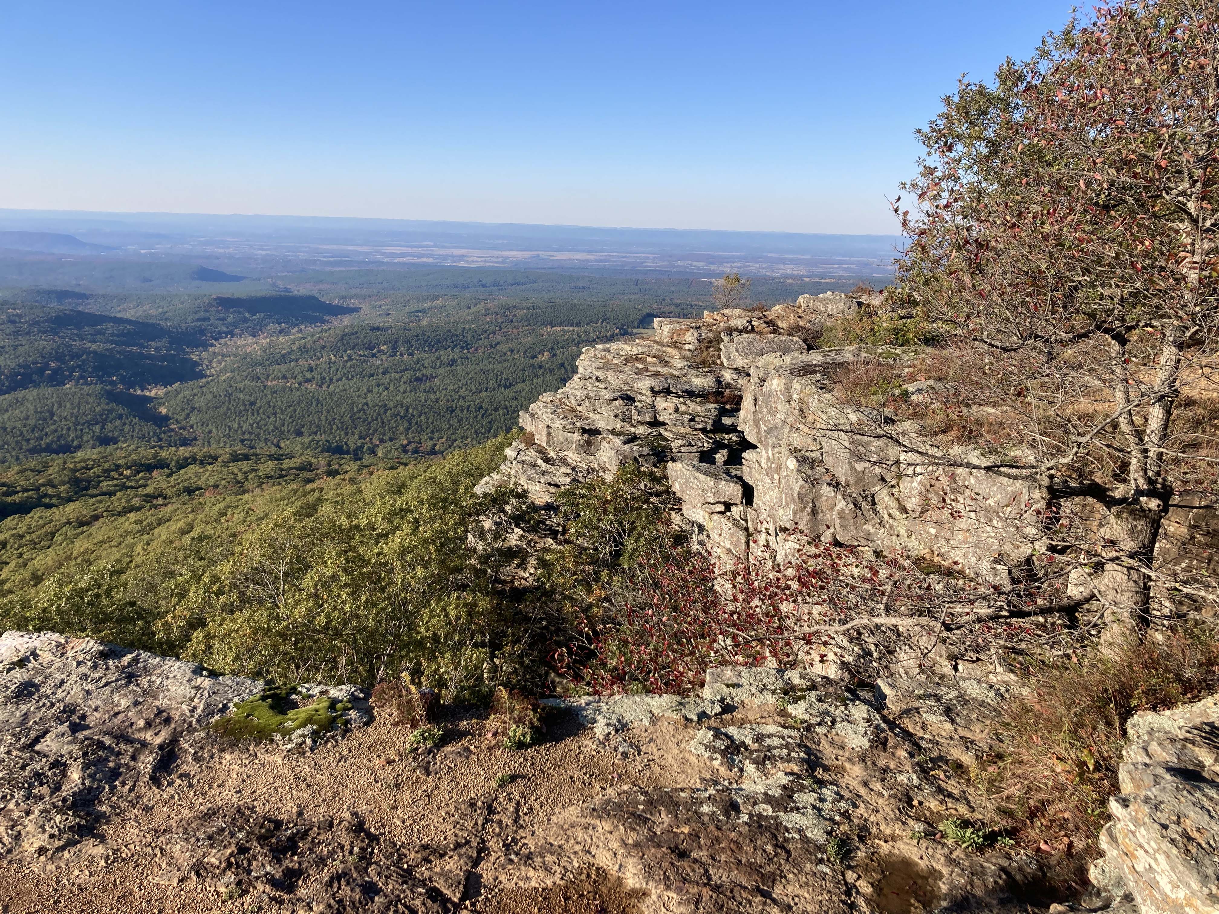
A couple of days ago we hiked to the highest point in Arkansas. Signal Hill, the 2,753-foot-tall mound atop Mount Magazine, is hardly lofty according to mountain standards, but it is still a cool place to visit. If you choose to be a stickler about such things, Mount Magazine is not a mountain at all, but an isolated mesa. A kind of island in the sky.
Mount Magazine, Mount Nebo, Petit Jean Mountain and other smaller mesas — the names of which I could never remember — have intrigued me since first seeing them 50 years ago as I made my monthly trips to Little Rock. They are not mountains because, at least according to geological convention, mountains are formed by the uplift of sedimentary rocks or by volcanic eruptions.
Driving up the side of any of these structures it is easy to see that the rock strata are horizontal and stacked layer-cake style, just as they are in the Ozarks. The term mesa is probably the best one to use; a flat-topped piece of land with horizontal bedding and steeply eroded sides. Plateaus are similar but can be created by uplift, volcanism or erosion and they are often tilted with one side having an exposed rock escarpment while the other is less distinct.
I’ve heard these sky islands described as either part of the Ouachita or Ozark Mountains, but in truth, they reside in a transition zone between the two prominent geologic features of western Arkansas, smack in the middle of the Arkoma Basin. They formed when the Ozark region was the southern boundary of what is now the North American continent. Even the Ozarks were periodically flooded by incoming seas but the area to the south was in deeper water and accumulated sediment for at least 235 million years. When the ocean was at it its deepest, the black shale layers were deposited, when a bit shallower sand and silts were deposited and sandstone or siltstones formed. When really shallow, limestone rocks formed but there are fewer limestone rocks in south Arkansas than in the Ozark region.
About 300 million years ago at the end of the Pennsylvanian period, the South American plate began moving north, buckling the subterranean rocks in east-west running faults and generally raising the level of the whole region. The largest of these dipping faults (called a syncline) is today called the Arkoma Basin. This basin forms the basis of the trough through the region where the Arkansas River now runs and is the lowland where coal beds formed in the river valley.
The uplift of the Ouachita Mountains was unusual because it did not include the usual fire and brimstone approach of most mountain building events. There is no granite – molten subterranean rock – exposed anywhere in Arkansas. The chain rose by slow, steady pressure from the south which lifted, and sometimes overturned, giant slabs of ancient rocks. Subsurface rock deformation from the Ouachita orogeny is found from Alabama to southern Texas, but only the rocks in Arkansas and southeastern Oklahoma rose to form actual mountains. This mountain-building epoch went on for more than 50 million years and ended by 250 million years ago. The Ouachita Mountains were thought to have risen to a height of 10,000 feet. But exposed edges on these upturned rocks lead to “rapid” erosion, and today the flat, hard sandstone cap of Mount Magazine towers above the 2,358-foot-tall Raspberry Mountain in Polk County.
Interestingly, the string of mesas down the Arkansas River Valley from Poteau Mountain in Oklahoma to Petit Jean Mountain was attached to part of this down-thrust syncline that formed the Arkoma Basin. The highest point in Arkansas – Signal Hill – has its roots in a down-thrust wave of stone, not atop a wave in an anticline. Probably at one time this string of high ground was joined in a more or less continuous band. But erosion from above and the migration of the ancestral Arkansas River from below ate at the high ground, leaving behind what geologists call a dissected plateau with these isolated, flat-topped promontories.