The Alaska Highway
Contact
University of Arkansas System Division of Agriculture
Cooperative Extension Service
2301 S. University Ave.
Little Rock, AR 72204

The Alaska Highway
I have long wanted to visit Alaska, but driving there wasn’t high on my priority list because I had heard all the stories about how demanding the trip was. I had talked to a few people who had made the trip but didn’t know anyone in my circle of friends or family who had made the drive. So the prospects seemed a bit scary. But I finally decided to take the plunge and see for myself.
Old stories are hard to kill. One of the common tales is that the road is mostly gravel, and we all know that can get tedious. Another common bit of folklore is that anyone undertaking the trip should have Jerry cans full of gas tied to the bumper and at least two spare tires. None of these concerns are true. It is a long road, but as roads go, it is mostly pretty good.
The modern length of the Alaska Highway (also called the AlCan Highway) is 1,387 miles, but Dawson Creek, British Columbia where it officially starts is about 2,000 miles from Fayetteville. But my journey was not such a straight shot. I picked up my traveling companion in Seattle, we drove the length of Victoria Island and then hopped on a British Columbia Ferry for a 400-mile float up the inner-coastal waterway to Prince Rupert, B.C. where we started our land journey north. We drove 600 miles north on the Cassiar Stewart Highway (B.C. 37), joining the Alaska Highway near its midpoint near Watson Lake in Yukon Territory. I did follow the Alaska Highway all the way back on my solo trip home.
The original highway was punched through from Dawson Creek to Delta Junction, Alaska in 1942 after Japan attacked Pearl Harbor. Dawson Creek is where the railroad ended and the wilderness began. Canada supplied the right of way and some resources for road construction, all in exchange for ownership of the road when the war was over. It took eight months for the Army Corps of Engineers, about 10,000 soldiers — 3,000 of whom were Blacks trained in Louisiana — and a cadre of private contractors to complete the task. Construction began in three locations: the two ends and at a place now called Haines Junction where supplies were shipped in from the relatively close seaport of Haines, Alaska. The work started in March and was deemed complete by October 28 of that same year.
The original road was not the modern highway it is today. Originally, only three steel bridges were installed on a roadway that had more than 2,000 bridges — pontoon bridges were used on larger rivers with wooden bridges for smaller crossings. Hills were steep with many switchbacks needed to climb the grades. The first year only heavy Army trucks could make the trip. Civilian traffic was allowed on it in 1948 and these early travelers were probably the source of the legends surrounding the road.
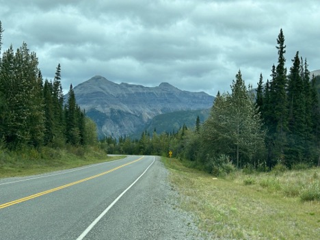
Over the years the Canadian government has improved the road and brought it up to modern standards. Today it reminds me of half of a modern interstate with wide, sweeping curves and at least 150 feet of cleared right of way on each side. It is entirely paved, but there is a 40-mile stretch in Yukon Territory in a perpetual state of repair because of the thawed permafrost in that area. In this stretch, the pavement has sometimes been ripped up and replaced with gravel. That is actually a good thing, because the still-paved sections are riddled with teeth-rattling potholes.
Part of the trepidation the roadway causes is that there are long, lonely stretches of highway and it is not unusual to go miles without meeting another car. It is for sure a lonely road. Most of us are used to seeing a gas station every few miles and we get complacent about watching the fuel gauge. If I remember right, the longest stretch I saw between fuel stops was about 160 miles, but some of the establishments offering fuel in isolated areas looked rather sketchy. I always fueled up when I reached the halfway point and never had any problems.
Whitehorse, Yukon Territory is the only city along the route but there are at least seven small towns along the way that provide all the basic services a traveler might need. A number of lodges, almost always with fuel and occasionally a restaurant, are scattered between the small villages.
So, in summary, the Alaska Highway is an easy drive provided you have the time. I followed a Prius along most of the route back and he reported no troubles whatsoever. But, the road is not yet ready for EVs, so don’t bring your Tesla unless you are towing a generator.