Contact
Katie Teague (kteague@uada.edu)
Jane Maginot (jmaginot@uada.edu)
Kristen Crawley (kcrawley@uada.edu)
Washington County Extension
479-444-1755
2536 N. McConnell Ave.
Fayetteville, AR 72704
Stay Connected
![]()
![]()
![]()
Urban Creek Guide
Why creeks?
When it rains, water that is not soaked into the ground becomes stormwater runoff. Runoff finds its way downhill initially to creeks. Creeks then merge to form larger creeks or streams, then rivers, until eventually they meet the ocean. Creeks provide a great source of passive recreation like wading, walking, birding, and enjoying nature.
Tips:
- Safety first. Some creeks could be high and fast-moving after rain. Use caution and check for warnings before going. Some streams have real-time gauges that can be checked at USGS WaterWatch.
- Obey park rules. Following rules on posted signage helps keep you and others safe, and keeps the sites open and available to everyone.
- Bring a bag to collect trash. While some litter can come from the people recreating before you, plenty of litter in our creeks and streams comes from our streets and parking lots when it rains. In Arkansas, storm drains lead to creeks.
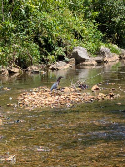
- Look under rocks for benthics. Benthic Macroinvertebrates are insects that live on the bottom of streams and are indicators of water quality because they cannot escape pollution. More benthics of different species indicate a healthy stream.
- Leave no trace. Follow leave no trace principles like disposing of waste properly, leaving what you find, respecting wildlife, and being considerate of others.
- Wear sandals or water shoes. Rocks on the bottom of creeks can be slippery or sharp.
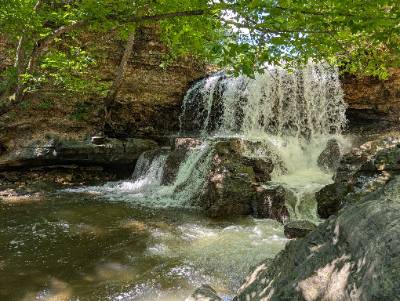
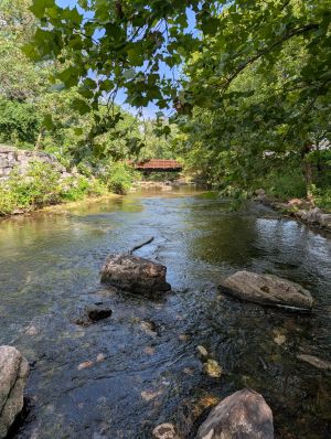
Tanyard Creek
Access Point: Tanyard Creek Nature Trail, Bella Vista
Best for: Scenery
Route to Ocean: Tanyard Creek → Little Sugar Creek → Elk River → Neosho River → Arkansas River → Mississippi River → Gulf of Mexico
The Tanyard Creek Nature Trail has many spots to dip your toes in Tanyard Creek. The waterfall, which is fed by Lake Windsor, is worth the short hike.
Blowing Springs
Access Point: Blowing Springs, Bella Vista
Best for: Date Night
Route to Ocean: Little Sugar Creek → Elk River → Neosho River → Arkansas River → Mississippi River → Gulf of Mexico
Follow Blowing Springs Rd to the Gear Garden to find this beautiful and cold spring. With food trucks, a beer garden, and live music, it’s a popular place on nights and weekends.
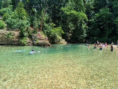
McKisic Creek "Blue Hole"
Access Point: Wishing Springs Trail parking on NW Wishing Springs Dr, Bentonville
Best for: Swimming
Route to Ocean: McKisic Creek → Little Sugar Creek → Elk River → Neosho River → Arkansas River → Mississippi River → Gulf of Mexico
Blue Hole is a popular swimming hole complete with gravel bar and a rope swing. Get there early to claim your spot at the deep blue hole, or venture downstream for more space.
Park Springs
Access Point: Park Springs Park, Bentonville
Best for: Cold water
Route to Ocean: Black Apple Creek → Town Branch Creek → McKisic Creek →Little Sugar Creek → Elk River → Neosho River → Arkansas River → Mississippi River → Gulf of Mexico
Park Springs Park is close to downtown Bentonville and has a history as a former hotel and resort spot. The springs pump out cold, refreshing water, and the creek is home to many critters and mosses. Be mindful of mountain bikers riding through on the trail.
Coler Creek
Access Point: Coler Mountain Bike Preserve
Best for: Taking a dip after a bike ride
Route to Ocean: Coler Creek → McKisic Creek → Little Sugar Creek → Elk River → Neosho River → Arkansas River → Mississippi River → Gulf of Mexico
Coler Mountain Bike Preserve has many access points to spread out and enjoy the creek. The park has extra parking lots to accommodate visitors looking to bike, walk, or wade in the creek. Frequent signage along the trail provides educational opportunities. Bring your walking shoes and wallet to experience Airship Coffee along the trail.
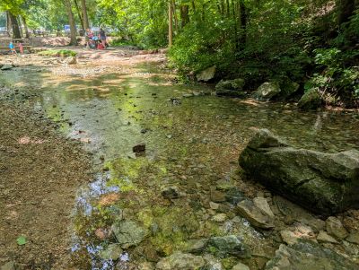
McKisic Creek
Access Point: McKisic Springs Station Park, Centerton
Best for: A picnic
Route to Ocean: McKisic Creek → Little Sugar Creek → Elk River → Neosho River → Arkansas River → Mississippi River → Gulf of Mexico
McKisic Creek at McKissic Springs Park is a shallow and slow-moving creek with easy access to dip your toes in. There are lots of cool rocks and shells on the creek bottom to look at.
Lake Atalanta
Access Point: Lake Atalanta Park, Rogers
Best for: Ecological design
Route to Ocean: Prairie Creek → Beaver Lake → White River → Mississippi River → Gulf of Mexico
Frisco and Diamond Springs feed into Lake Atalanta, a 37 acre lake with a boardwalk and fishing piers. The creek portion is easy access from the parking lots and several constructed pools are great for catching tadpoles. The park has green infrastructure elements like permeable pavers, that work to soak in stormwater, decreasing runoff volume.
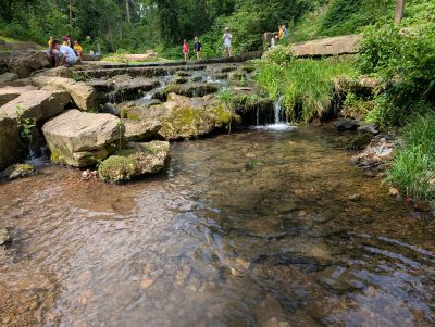
Spring Creek
Access point: Lake Springdale Trailhead, Springdale
Best for: Wildlife
Route to Ocean: Spring Creek → Osage Creek → Illinois River → Arkansas River → Mississippi River → Gulf of Mexico
Take the footpath to the side of the bridge to wade in Spring Creek. Over the bridge is a nice walking trail and fishing on Lake Springdale.
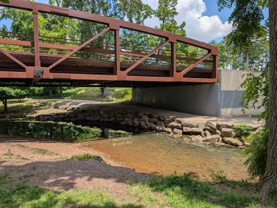
Sager Creek
Access Point: Bob Henry Park, Siloam Springs
Best for: A walk along the creek
Route to Ocean: Sager Creek → Flint Creek → Illinois River → Arkansas River → Mississippi River → Gulf of Mexico
Sager Creek runs through historic downtown Siloam Springs and provides a picturesque view to three city parks: Twin Springs Park, City Park, and Bob Henry Park. Listen to the babbling creek while strolling along the Dogwood Springs Walking Trail or doing some downtown shopping.
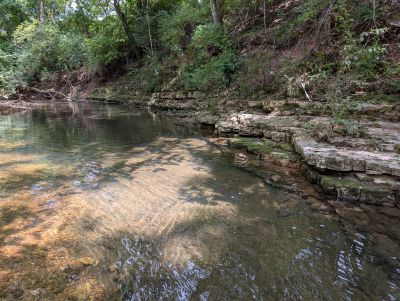
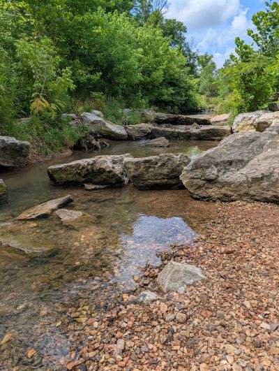
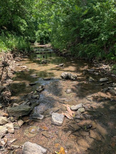
Clear Creek
Access Point: Nature Preserve on Main St in Johnson
Best for: Skipping rocks
Route to Ocean: Clear Creek → Illinois River → Arkansas River → Mississippi River → Gulf of Mexico
Enjoy a short walk through a restored prairie to get to this access point. This creek site is clear and quiet most days and is great for skipping rocks or bringing your dog for a swim. The creek bank has a slight slope at the access point and could be less accessible for some.
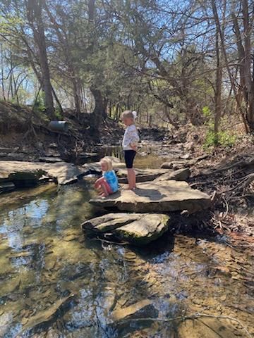
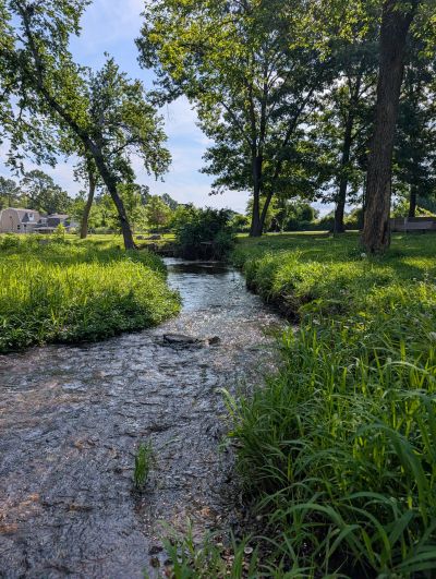
Niokaska Creek
Access Point: Gulley Park, Fayetteville
Best for: Easy access into creek
Route to Ocean: Niokaska Creek → Mud Creek → Scull Creek → Clear Creek → Illinois River → Arkansas River →Mississippi River → Gulf of Mexico
Niokaska Creek runs through one of Fayetteville’s most popular parks, Gulley Park. Creek access is easy with rock steps down the creek banks and close to the parking lot off Township. With plenty of shade and big rocks to sit on, this creek is very inviting.
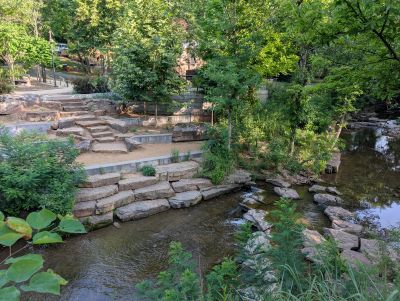
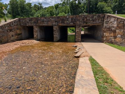
Tanglewood Branch
Access Point: Lower Ramble, Fayetteville
Best for: Community events
Route to Ocean: Tanglewood Branch → Town Branch → West Fork of White River → Beaver Lake → White River → Mississippi River → Gulf of Mexico
This recently restored site at the Lower Ramble has history, architecture, native plants, and a beautiful inviting creek. This creek leads to Beaver Lake, the drinking water source to 1 in 5 Arkansans.
Farmington Branch
Access Point: Creekside Park, Farmington
Best for: Quiet
Route to Ocean: Farmington Branch → Goose Creek → Illinois River → Arkansas River → Mississippi River → Gulf of Mexico
This creek is almost fully shaded and home to lots of fish and critters. The park has a nice, paved walking trail and is a nice place to bring your dog. Away from the main I-49 corridor, this park is great for a little quiet time.
Want to participate in a creek cleanup?